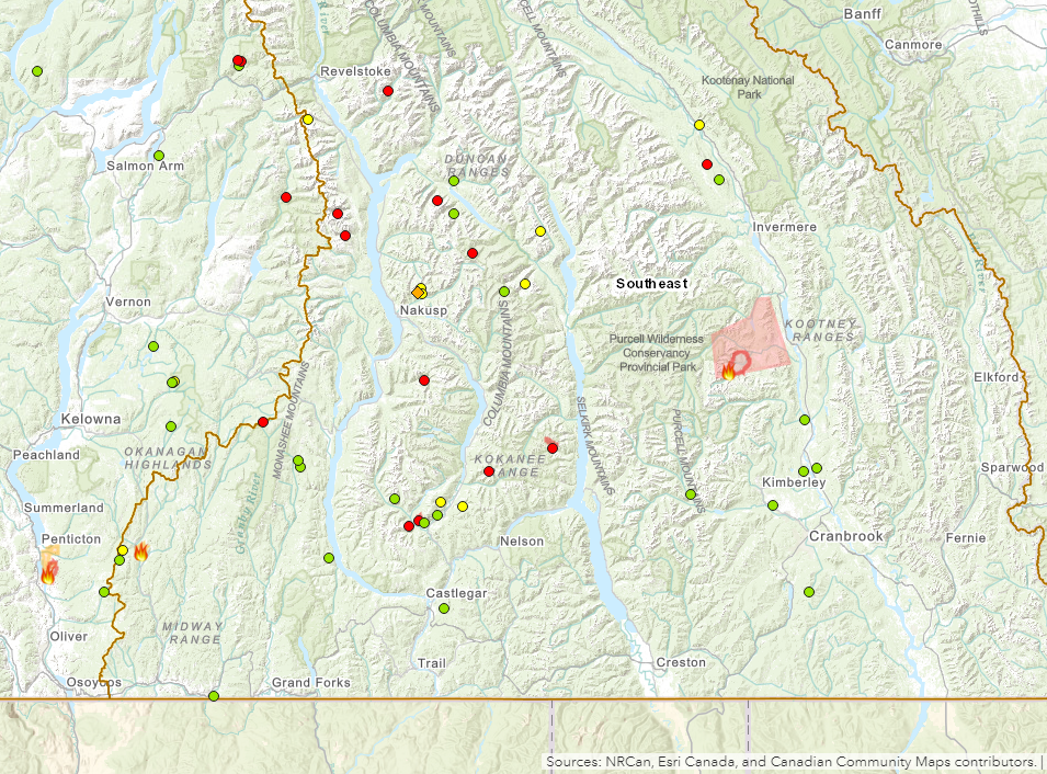

The largest wildfire in the West Kootenay remains the Woodbury Creek Wildfire near Kokanee Glacier Provincial Park, as the BC Wildfire Service continues its response to 45 fires in the entire Southeast Fire Centre.
In the RDCK and RDKB specifically, there are 28 active wildfires as of Friday morning. Besides a brand new fire start northwest of Nakusp near Raven Creek, 10 of the regional wildfires are “under control”, another 8 are “being held”, and 9 are still deemed “out of control” by the BC Wildfire Service.
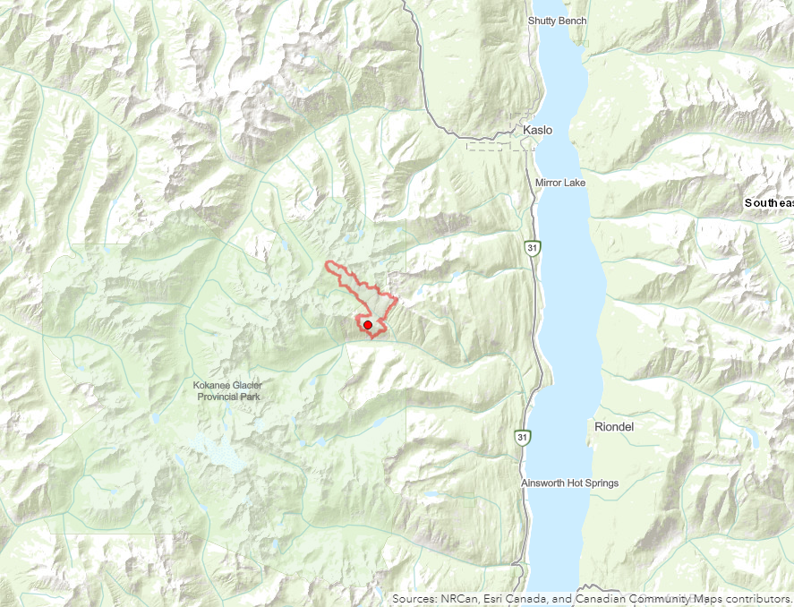
The Woodbury Creek Wildfire remains the largest in the region at an estimated 480 hectares. At this time, the blaze is still being monitored by the BC Wildfire Service as it continues to burn in steep terrain on the eastern side of Kokanee Glacier Provincial Park and approximately 12 kilometres southeast of Kaslo.
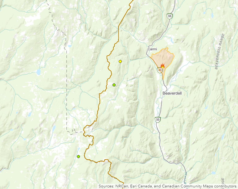
The 23.5-hectare Solomon Mountain Wildfire north of Beaverdell is now being held by the BC Wildfire Service and the Evacuation Alert from the RDKB has been rescinded. It’s expected the fire will be under control in the coming days as 20 firefighting personnel, three water tenders, and two helicopters were providing support on the wildfire.
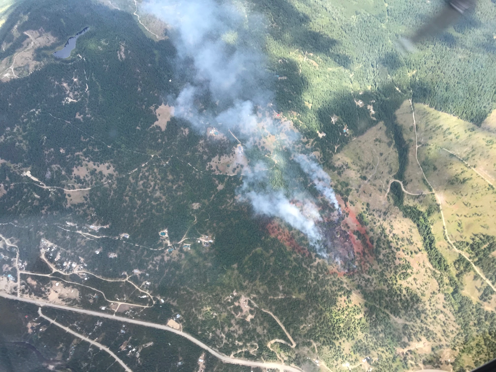
Three small wildfires are burning northwest of Nakusp, but two of them are being held, besides a new 0.01 wildfire start near Raven Creek. All three of the fires are suspected to have been sparked by lightning strikes.
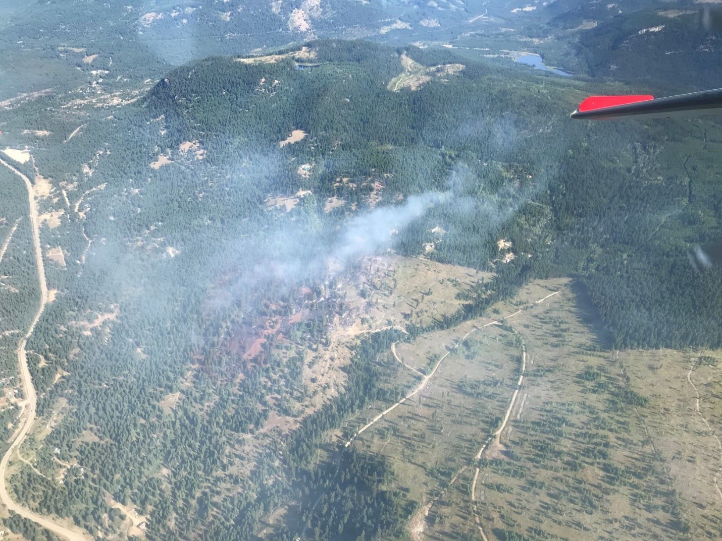
The majority of the region’s wildfires are located in and around the Winlaw, Perry Peak, and Kokanee Glacier Provincial Park. Three are under control, two are being held, and two are still out of control.
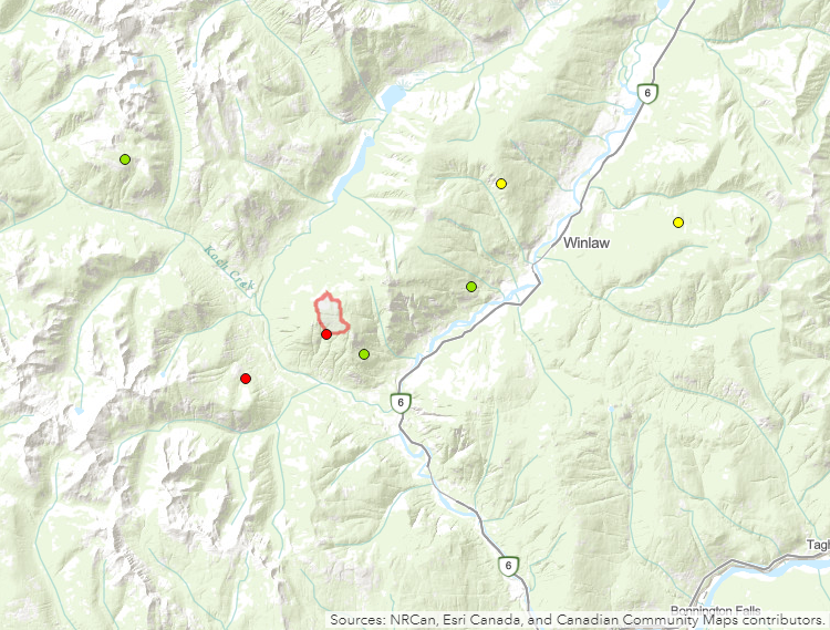
As per the BC Wildfire Service, the Talbot Creek Wildfire near Perry Peak is estimated at 160 hectares. The other “out of control” wildfire is a smaller 1.06-hectare fire near Airy Creek. All of the fires in that area are suspected to have been caused by lightning strikes, with the majority sparking on Monday or Tuesday earlier in the week.